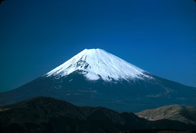
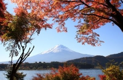
Mount Fuji is the highest mountain in Japan at 3,776 m (12,388 ft). Along with Mount Tate and Mount Haku, it is one of Japan's "Three Holy Mountains". An active volcano that last erupted in 1707–08, Mount Fuji straddles the boundary of Shizuoka and Yamanashi prefectures just west of Tokyo, from which it can be seen on a clear day. It is located near the Pacific coast of central Honshū. Three small cities surround it: Gotemba (south), Fujiyoshida (north) and Fujinomiya (southwest). Mount Fuji's exceptionally symmetrical cone is a well-known symbol of Japan and it is frequently depicted in art and photographs, as well as visited by sightseers and climbers.
It is thought that the first ascent was in 663 by an anonymous monk. The summit has been thought of as sacred since ancient times and was forbidden to women until the Meiji Era.
The first ascent by a foreigner was by Sir Rutherford Alcock in September 1860, from the foot of the mountain to the top in eight hours and three hours for the descent. Alcock's brief narrative in The Capital of the Tycoon was the first widely disseminated description of the mountain in the West.[17] Lady Fanny Parkes, the wife of British ambassador Sir Harry Parkes, was the first non-Japanese woman to ascend Mount Fuji in 1867; and photographer Felix Beato climbed Mount Fuji in that same year.
Today, Mount Fuji is an international tourist destination and common destination for mountain-climbing. In the early 20th century, populist educator Frederick Starr's Chautauqua lectures about his several ascents of Mount Fuji—1913, 1919, and 1923—were widely known in America. A well-known Japanese saying suggests that anybody would be a fool not to climb Mt. Fuji once—but a fool to do so twice.
Mount Fuji is an attractive volcanic cone and a frequent subject of Japanese art. Amongst the most renowned works are Hokusai's 36 Views of Mount Fuji and his One Hundred Views of Mount Fuji. The mountain is mentioned in Japanese literature throughout the ages and the subject of many poems. The mountain is also the basis of the Infiniti logo.
Mt. Fuji also houses a warrior tradition: ancient samurai used the base of the mountain as a remote training area, near the present day town of Gotemba. The shogun Minamoto no Yoritomo held yabusame in the area in the early Kamakura period. As of 2006, the Japan Self-Defense Forces and the United States Marine Corps operate military bases near Mount Fuji.
The most popular period for people to hike up Mt. Fuji is from 1 July to 27 August, while huts and other facilities are operating. Buses to the fifth station start running on 1 July. Some climb the mountain at night in order to be in a position at or near the summit when the sun rises.
There are four major routes from the fifth station to the summit with an additional four routes from the foot of the mountain. The major routes from the fifth station are (clockwise) the Kawaguchiko, Subashiri, Gotemba, and Fujinomiya routes. The routes from the foot of the mountain are the Shojiko, Yoshida, Suyama, and Murayama routes. The stations on different routes are at different elevations. The highest fifth station is located at Fujinomiya, followed by Kawaguchi, Subashiri, and Gotemba.
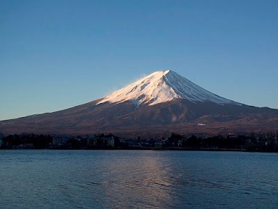
Even though it is only the second highest fifth stations, the Kawaguchiko route is the most popular route because of its large parking area and many large mountain huts where a climber can rest or stay. During the summer season, most Mount Fuji climbing tour buses arrive there. The next popular is the Fujinomiya route which has the highest fifth station, followed by Subashiri and Gotemba.
Even though most climbers do not climb the Subashiri and Gotemba routes, many descend these because of their ash-covered paths. From the seventh station to near the fifth station, one could run down these ash-covered paths in approximately 30 minutes. Besides these routes, there are tractor routes along the climbing routes. These tractor routes are used to bring food and other materials to huts on the mountain. Because the tractors usually take up most of the width of these path and they tend to push large rocks from the side of the path, the tractor paths are off-limits to the climbers on sections that are not merged with the climbing or descending paths. Nevertheless, one can sometimes see people riding mountain bikes along the tractor routes down from the summit. This is particularly risky, as it becomes difficult to control speed and may send some rocks rolling along the side of the path, which may hit other people.
The four routes from the foot of the mountain offer historical sites. The Murayama is the oldest Mount Fuji route and the Yoshida route still has many old shrines, teahouses, and huts along its path. These routes are gaining popularity recently and are being restored, but climbing from the foot of the mountain is still relatively uncommon. Also, bears have been sighted along the Yoshida route.
An estimated 200,000 people climb Mount Fuji every year, 30% of whom are foreigners. The ascent from the new fifth station can take anywhere between three and eight hours while the descent can take from two to five hours. The hike from the foot of the mountain is divided into 10 stations, and there are paved roads up to the fifth station, which is about 2,300 meters above sea level. Huts at and above the fifth stations are usually manned during the climbing season, but huts below fifth stations are not usually manned for climbers. The number of open huts on routes are proportional to the number of climbers - Kawaguchiko has the most while Gotemba has the least. The huts along the Gotemba route also tend to start later and close earlier than those at the Kawaguchiko route. Also, because Mount Fuji is designated as a national park, it is illegal to tent above the fifth station.
There are eight peaks around the crater at the summit. The highest point in Japan is where the Mount Fuji Radar System used to be. Climbers are able to visit each of these peaks.
Mount Fuji is the highest mountain in Japan at 3,776 m (12,388 ft). Along with Mount Tate and Mount Haku, it is one of Japan's "Three Holy Mountains". An active volcano that last erupted in 1707–08, Mount Fuji straddles the boundary of Shizuoka and Yamanashi prefectures just west of Tokyo, from which it can be seen on a clear day. It is located near the Pacific coast of central Honshū. Three small cities surround it: Gotemba (south), Fujiyoshida (north) and Fujinomiya (southwest). Mount Fuji's exceptionally symmetrical cone is a well-known symbol of Japan and it is frequently depicted in art and photographs, as well as visited by sightseers and climbers.
It is thought that the first ascent was in 663 by an anonymous monk. The summit has been thought of as sacred since ancient times and was forbidden to women until the Meiji Era.
The first ascent by a foreigner was by Sir Rutherford Alcock in September 1860, from the foot of the mountain to the top in eight hours and three hours for the descent. Alcock's brief narrative in The Capital of the Tycoon was the first widely disseminated description of the mountain in the West.[17] Lady Fanny Parkes, the wife of British ambassador Sir Harry Parkes, was the first non-Japanese woman to ascend Mount Fuji in 1867; and photographer Felix Beato climbed Mount Fuji in that same year.
Today, Mount Fuji is an international tourist destination and common destination for mountain-climbing. In the early 20th century, populist educator Frederick Starr's Chautauqua lectures about his several ascents of Mount Fuji—1913, 1919, and 1923—were widely known in America. A well-known Japanese saying suggests that anybody would be a fool not to climb Mt. Fuji once—but a fool to do so twice.
Mount Fuji is an attractive volcanic cone and a frequent subject of Japanese art. Amongst the most renowned works are Hokusai's 36 Views of Mount Fuji and his One Hundred Views of Mount Fuji. The mountain is mentioned in Japanese literature throughout the ages and the subject of many poems. The mountain is also the basis of the Infiniti logo.
Mt. Fuji also houses a warrior tradition: ancient samurai used the base of the mountain as a remote training area, near the present day town of Gotemba. The shogun Minamoto no Yoritomo held yabusame in the area in the early Kamakura period. As of 2006, the Japan Self-Defense Forces and the United States Marine Corps operate military bases near Mount Fuji.
The most popular period for people to hike up Mt. Fuji is from 1 July to 27 August, while huts and other facilities are operating. Buses to the fifth station start running on 1 July. Some climb the mountain at night in order to be in a position at or near the summit when the sun rises.
There are four major routes from the fifth station to the summit with an additional four routes from the foot of the mountain. The major routes from the fifth station are (clockwise) the Kawaguchiko, Subashiri, Gotemba, and Fujinomiya routes. The routes from the foot of the mountain are the Shojiko, Yoshida, Suyama, and Murayama routes. The stations on different routes are at different elevations. The highest fifth station is located at Fujinomiya, followed by Kawaguchi, Subashiri, and Gotemba.
Even though it is only the second highest fifth stations, the Kawaguchiko route is the most popular route because of its large parking area and many large mountain huts where a climber can rest or stay. During the summer season, most Mount Fuji climbing tour buses arrive there. The next popular is the Fujinomiya route which has the highest fifth station, followed by Subashiri and Gotemba.
Even though most climbers do not climb the Subashiri and Gotemba routes, many descend these because of their ash-covered paths. From the seventh station to near the fifth station, one could run down these ash-covered paths in approximately 30 minutes. Besides these routes, there are tractor routes along the climbing routes. These tractor routes are used to bring food and other materials to huts on the mountain. Because the tractors usually take up most of the width of these path and they tend to push large rocks from the side of the path, the tractor paths are off-limits to the climbers on sections that are not merged with the climbing or descending paths. Nevertheless, one can sometimes see people riding mountain bikes along the tractor routes down from the summit. This is particularly risky, as it becomes difficult to control speed and may send some rocks rolling along the side of the path, which may hit other people.
The four routes from the foot of the mountain offer historical sites. The Murayama is the oldest Mount Fuji route and the Yoshida route still has many old shrines, teahouses, and huts along its path. These routes are gaining popularity recently and are being restored, but climbing from the foot of the mountain is still relatively uncommon. Also, bears have been sighted along the Yoshida route.
An estimated 200,000 people climb Mount Fuji every year, 30% of whom are foreigners. The ascent from the new fifth station can take anywhere between three and eight hours while the descent can take from two to five hours. The hike from the foot of the mountain is divided into 10 stations, and there are paved roads up to the fifth station, which is about 2,300 meters above sea level. Huts at and above the fifth stations are usually manned during the climbing season, but huts below fifth stations are not usually manned for climbers. The number of open huts on routes are proportional to the number of climbers - Kawaguchiko has the most while Gotemba has the least. The huts along the Gotemba route also tend to start later and close earlier than those at the Kawaguchiko route. Also, because Mount Fuji is designated as a national park, it is illegal to tent above the fifth station.
There are eight peaks around the crater at the summit. The highest point in Japan is where the Mount Fuji Radar System used to be. Climbers are able to visit each of these peaks.
It is thought that the first ascent was in 663 by an anonymous monk. The summit has been thought of as sacred since ancient times and was forbidden to women until the Meiji Era.
The first ascent by a foreigner was by Sir Rutherford Alcock in September 1860, from the foot of the mountain to the top in eight hours and three hours for the descent. Alcock's brief narrative in The Capital of the Tycoon was the first widely disseminated description of the mountain in the West.[17] Lady Fanny Parkes, the wife of British ambassador Sir Harry Parkes, was the first non-Japanese woman to ascend Mount Fuji in 1867; and photographer Felix Beato climbed Mount Fuji in that same year.
Today, Mount Fuji is an international tourist destination and common destination for mountain-climbing. In the early 20th century, populist educator Frederick Starr's Chautauqua lectures about his several ascents of Mount Fuji—1913, 1919, and 1923—were widely known in America. A well-known Japanese saying suggests that anybody would be a fool not to climb Mt. Fuji once—but a fool to do so twice.
Mount Fuji is an attractive volcanic cone and a frequent subject of Japanese art. Amongst the most renowned works are Hokusai's 36 Views of Mount Fuji and his One Hundred Views of Mount Fuji. The mountain is mentioned in Japanese literature throughout the ages and the subject of many poems. The mountain is also the basis of the Infiniti logo.
Mt. Fuji also houses a warrior tradition: ancient samurai used the base of the mountain as a remote training area, near the present day town of Gotemba. The shogun Minamoto no Yoritomo held yabusame in the area in the early Kamakura period. As of 2006, the Japan Self-Defense Forces and the United States Marine Corps operate military bases near Mount Fuji.
The most popular period for people to hike up Mt. Fuji is from 1 July to 27 August, while huts and other facilities are operating. Buses to the fifth station start running on 1 July. Some climb the mountain at night in order to be in a position at or near the summit when the sun rises.
There are four major routes from the fifth station to the summit with an additional four routes from the foot of the mountain. The major routes from the fifth station are (clockwise) the Kawaguchiko, Subashiri, Gotemba, and Fujinomiya routes. The routes from the foot of the mountain are the Shojiko, Yoshida, Suyama, and Murayama routes. The stations on different routes are at different elevations. The highest fifth station is located at Fujinomiya, followed by Kawaguchi, Subashiri, and Gotemba.
Even though it is only the second highest fifth stations, the Kawaguchiko route is the most popular route because of its large parking area and many large mountain huts where a climber can rest or stay. During the summer season, most Mount Fuji climbing tour buses arrive there. The next popular is the Fujinomiya route which has the highest fifth station, followed by Subashiri and Gotemba.
Even though most climbers do not climb the Subashiri and Gotemba routes, many descend these because of their ash-covered paths. From the seventh station to near the fifth station, one could run down these ash-covered paths in approximately 30 minutes. Besides these routes, there are tractor routes along the climbing routes. These tractor routes are used to bring food and other materials to huts on the mountain. Because the tractors usually take up most of the width of these path and they tend to push large rocks from the side of the path, the tractor paths are off-limits to the climbers on sections that are not merged with the climbing or descending paths. Nevertheless, one can sometimes see people riding mountain bikes along the tractor routes down from the summit. This is particularly risky, as it becomes difficult to control speed and may send some rocks rolling along the side of the path, which may hit other people.
The four routes from the foot of the mountain offer historical sites. The Murayama is the oldest Mount Fuji route and the Yoshida route still has many old shrines, teahouses, and huts along its path. These routes are gaining popularity recently and are being restored, but climbing from the foot of the mountain is still relatively uncommon. Also, bears have been sighted along the Yoshida route.
An estimated 200,000 people climb Mount Fuji every year, 30% of whom are foreigners. The ascent from the new fifth station can take anywhere between three and eight hours while the descent can take from two to five hours. The hike from the foot of the mountain is divided into 10 stations, and there are paved roads up to the fifth station, which is about 2,300 meters above sea level. Huts at and above the fifth stations are usually manned during the climbing season, but huts below fifth stations are not usually manned for climbers. The number of open huts on routes are proportional to the number of climbers - Kawaguchiko has the most while Gotemba has the least. The huts along the Gotemba route also tend to start later and close earlier than those at the Kawaguchiko route. Also, because Mount Fuji is designated as a national park, it is illegal to tent above the fifth station.
There are eight peaks around the crater at the summit. The highest point in Japan is where the Mount Fuji Radar System used to be. Climbers are able to visit each of these peaks.
Mount Fuji is the highest mountain in Japan at 3,776 m (12,388 ft). Along with Mount Tate and Mount Haku, it is one of Japan's "Three Holy Mountains". An active volcano that last erupted in 1707–08, Mount Fuji straddles the boundary of Shizuoka and Yamanashi prefectures just west of Tokyo, from which it can be seen on a clear day. It is located near the Pacific coast of central Honshū. Three small cities surround it: Gotemba (south), Fujiyoshida (north) and Fujinomiya (southwest). Mount Fuji's exceptionally symmetrical cone is a well-known symbol of Japan and it is frequently depicted in art and photographs, as well as visited by sightseers and climbers.
It is thought that the first ascent was in 663 by an anonymous monk. The summit has been thought of as sacred since ancient times and was forbidden to women until the Meiji Era.
The first ascent by a foreigner was by Sir Rutherford Alcock in September 1860, from the foot of the mountain to the top in eight hours and three hours for the descent. Alcock's brief narrative in The Capital of the Tycoon was the first widely disseminated description of the mountain in the West.[17] Lady Fanny Parkes, the wife of British ambassador Sir Harry Parkes, was the first non-Japanese woman to ascend Mount Fuji in 1867; and photographer Felix Beato climbed Mount Fuji in that same year.
Today, Mount Fuji is an international tourist destination and common destination for mountain-climbing. In the early 20th century, populist educator Frederick Starr's Chautauqua lectures about his several ascents of Mount Fuji—1913, 1919, and 1923—were widely known in America. A well-known Japanese saying suggests that anybody would be a fool not to climb Mt. Fuji once—but a fool to do so twice.
Mount Fuji is an attractive volcanic cone and a frequent subject of Japanese art. Amongst the most renowned works are Hokusai's 36 Views of Mount Fuji and his One Hundred Views of Mount Fuji. The mountain is mentioned in Japanese literature throughout the ages and the subject of many poems. The mountain is also the basis of the Infiniti logo.
Mt. Fuji also houses a warrior tradition: ancient samurai used the base of the mountain as a remote training area, near the present day town of Gotemba. The shogun Minamoto no Yoritomo held yabusame in the area in the early Kamakura period. As of 2006, the Japan Self-Defense Forces and the United States Marine Corps operate military bases near Mount Fuji.
The most popular period for people to hike up Mt. Fuji is from 1 July to 27 August, while huts and other facilities are operating. Buses to the fifth station start running on 1 July. Some climb the mountain at night in order to be in a position at or near the summit when the sun rises.
There are four major routes from the fifth station to the summit with an additional four routes from the foot of the mountain. The major routes from the fifth station are (clockwise) the Kawaguchiko, Subashiri, Gotemba, and Fujinomiya routes. The routes from the foot of the mountain are the Shojiko, Yoshida, Suyama, and Murayama routes. The stations on different routes are at different elevations. The highest fifth station is located at Fujinomiya, followed by Kawaguchi, Subashiri, and Gotemba.
Even though it is only the second highest fifth stations, the Kawaguchiko route is the most popular route because of its large parking area and many large mountain huts where a climber can rest or stay. During the summer season, most Mount Fuji climbing tour buses arrive there. The next popular is the Fujinomiya route which has the highest fifth station, followed by Subashiri and Gotemba.
Even though most climbers do not climb the Subashiri and Gotemba routes, many descend these because of their ash-covered paths. From the seventh station to near the fifth station, one could run down these ash-covered paths in approximately 30 minutes. Besides these routes, there are tractor routes along the climbing routes. These tractor routes are used to bring food and other materials to huts on the mountain. Because the tractors usually take up most of the width of these path and they tend to push large rocks from the side of the path, the tractor paths are off-limits to the climbers on sections that are not merged with the climbing or descending paths. Nevertheless, one can sometimes see people riding mountain bikes along the tractor routes down from the summit. This is particularly risky, as it becomes difficult to control speed and may send some rocks rolling along the side of the path, which may hit other people.
The four routes from the foot of the mountain offer historical sites. The Murayama is the oldest Mount Fuji route and the Yoshida route still has many old shrines, teahouses, and huts along its path. These routes are gaining popularity recently and are being restored, but climbing from the foot of the mountain is still relatively uncommon. Also, bears have been sighted along the Yoshida route.
An estimated 200,000 people climb Mount Fuji every year, 30% of whom are foreigners. The ascent from the new fifth station can take anywhere between three and eight hours while the descent can take from two to five hours. The hike from the foot of the mountain is divided into 10 stations, and there are paved roads up to the fifth station, which is about 2,300 meters above sea level. Huts at and above the fifth stations are usually manned during the climbing season, but huts below fifth stations are not usually manned for climbers. The number of open huts on routes are proportional to the number of climbers - Kawaguchiko has the most while Gotemba has the least. The huts along the Gotemba route also tend to start later and close earlier than those at the Kawaguchiko route. Also, because Mount Fuji is designated as a national park, it is illegal to tent above the fifth station.
There are eight peaks around the crater at the summit. The highest point in Japan is where the Mount Fuji Radar System used to be. Climbers are able to visit each of these peaks.


