Sunday, October 11, 2009

Visit Mount Fuji

Mount Fuji is the highest mountain in Japan at 3,776 m (12,388 ft). Along with Mount Tate and Mount Haku, it is one of Japan's "Three Holy Mountains". An active volcano that last erupted in 1707–08, Mount Fuji straddles the boundary of Shizuoka and Yamanashi prefectures just west of Tokyo, from which it can be seen on a clear day. It is located near the Pacific coast of central Honshū. Three small cities surround it: Gotemba (south), Fujiyoshida (north) and Fujinomiya (southwest). Mount Fuji's exceptionally symmetrical cone is a well-known symbol of Japan and it is frequently depicted in art and photographs, as well as visited by sightseers and climbers.

It is thought that the first ascent was in 663 by an anonymous monk. The summit has been thought of as sacred since ancient times and was forbidden to women until the Meiji Era.

Mount Fuji
The first ascent by a foreigner was by Sir Rutherford Alcock in September 1860, from the foot of the mountain to the top in eight hours and three hours for the descent. Alcock's brief narrative in The Capital of the Tycoon was the first widely disseminated description of the mountain in the West.[17] Lady Fanny Parkes, the wife of British ambassador Sir Harry Parkes, was the first non-Japanese woman to ascend Mount Fuji in 1867; and photographer Felix Beato climbed Mount Fuji in that same year.

Today, Mount Fuji is an international tourist destination and common destination for mountain-climbing. In the early 20th century, populist educator Frederick Starr's Chautauqua lectures about his several ascents of Mount Fuji—1913, 1919, and 1923—were widely known in America. A well-known Japanese saying suggests that anybody would be a fool not to climb Mt. Fuji once—but a fool to do so twice.

Mount Fuji is an attractive volcanic cone and a frequent subject of Japanese art. Amongst the most renowned works are Hokusai's 36 Views of Mount Fuji and his One Hundred Views of Mount Fuji. The mountain is mentioned in Japanese literature throughout the ages and the subject of many poems. The mountain is also the basis of the Infiniti logo.

Mt. Fuji also houses a warrior tradition: ancient samurai used the base of the mountain as a remote training area, near the present day town of Gotemba. The shogun Minamoto no Yoritomo held yabusame in the area in the early Kamakura period. As of 2006, the Japan Self-Defense Forces and the United States Marine Corps operate military bases near Mount Fuji.

The most popular period for people to hike up Mt. Fuji is from 1 July to 27 August, while huts and other facilities are operating. Buses to the fifth station start running on 1 July. Some climb the mountain at night in order to be in a position at or near the summit when the sun rises.

There are four major routes from the fifth station to the summit with an additional four routes from the foot of the mountain. The major routes from the fifth station are (clockwise) the Kawaguchiko, Subashiri, Gotemba, and Fujinomiya routes. The routes from the foot of the mountain are the Shojiko, Yoshida, Suyama, and Murayama routes. The stations on different routes are at different elevations. The highest fifth station is located at Fujinomiya, followed by Kawaguchi, Subashiri, and Gotemba.
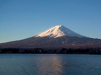
Mount Fuji
Even though it is only the second highest fifth stations, the Kawaguchiko route is the most popular route because of its large parking area and many large mountain huts where a climber can rest or stay. During the summer season, most Mount Fuji climbing tour buses arrive there. The next popular is the Fujinomiya route which has the highest fifth station, followed by Subashiri and Gotemba.

Even though most climbers do not climb the Subashiri and Gotemba routes, many descend these because of their ash-covered paths. From the seventh station to near the fifth station, one could run down these ash-covered paths in approximately 30 minutes. Besides these routes, there are tractor routes along the climbing routes. These tractor routes are used to bring food and other materials to huts on the mountain. Because the tractors usually take up most of the width of these path and they tend to push large rocks from the side of the path, the tractor paths are off-limits to the climbers on sections that are not merged with the climbing or descending paths. Nevertheless, one can sometimes see people riding mountain bikes along the tractor routes down from the summit. This is particularly risky, as it becomes difficult to control speed and may send some rocks rolling along the side of the path, which may hit other people.

The four routes from the foot of the mountain offer historical sites. The Murayama is the oldest Mount Fuji route and the Yoshida route still has many old shrines, teahouses, and huts along its path. These routes are gaining popularity recently and are being restored, but climbing from the foot of the mountain is still relatively uncommon. Also, bears have been sighted along the Yoshida route.

An estimated 200,000 people climb Mount Fuji every year, 30% of whom are foreigners. The ascent from the new fifth station can take anywhere between three and eight hours while the descent can take from two to five hours. The hike from the foot of the mountain is divided into 10 stations, and there are paved roads up to the fifth station, which is about 2,300 meters above sea level. Huts at and above the fifth stations are usually manned during the climbing season, but huts below fifth stations are not usually manned for climbers. The number of open huts on routes are proportional to the number of climbers - Kawaguchiko has the most while Gotemba has the least. The huts along the Gotemba route also tend to start later and close earlier than those at the Kawaguchiko route. Also, because Mount Fuji is designated as a national park, it is illegal to tent above the fifth station.

There are eight peaks around the crater at the summit. The highest point in Japan is where the Mount Fuji Radar System used to be. Climbers are able to visit each of these peaks.

Mount Fuji is the highest mountain in Japan at 3,776 m (12,388 ft). Along with Mount Tate and Mount Haku, it is one of Japan's "Three Holy Mountains". An active volcano that last erupted in 1707–08, Mount Fuji straddles the boundary of Shizuoka and Yamanashi prefectures just west of Tokyo, from which it can be seen on a clear day. It is located near the Pacific coast of central Honshū. Three small cities surround it: Gotemba (south), Fujiyoshida (north) and Fujinomiya (southwest). Mount Fuji's exceptionally symmetrical cone is a well-known symbol of Japan and it is frequently depicted in art and photographs, as well as visited by sightseers and climbers.

It is thought that the first ascent was in 663 by an anonymous monk. The summit has been thought of as sacred since ancient times and was forbidden to women until the Meiji Era.

The first ascent by a foreigner was by Sir Rutherford Alcock in September 1860, from the foot of the mountain to the top in eight hours and three hours for the descent. Alcock's brief narrative in The Capital of the Tycoon was the first widely disseminated description of the mountain in the West.[17] Lady Fanny Parkes, the wife of British ambassador Sir Harry Parkes, was the first non-Japanese woman to ascend Mount Fuji in 1867; and photographer Felix Beato climbed Mount Fuji in that same year.

Today, Mount Fuji is an international tourist destination and common destination for mountain-climbing. In the early 20th century, populist educator Frederick Starr's Chautauqua lectures about his several ascents of Mount Fuji—1913, 1919, and 1923—were widely known in America. A well-known Japanese saying suggests that anybody would be a fool not to climb Mt. Fuji once—but a fool to do so twice.

Mount Fuji is an attractive volcanic cone and a frequent subject of Japanese art. Amongst the most renowned works are Hokusai's 36 Views of Mount Fuji and his One Hundred Views of Mount Fuji. The mountain is mentioned in Japanese literature throughout the ages and the subject of many poems. The mountain is also the basis of the Infiniti logo.

Mt. Fuji also houses a warrior tradition: ancient samurai used the base of the mountain as a remote training area, near the present day town of Gotemba. The shogun Minamoto no Yoritomo held yabusame in the area in the early Kamakura period. As of 2006, the Japan Self-Defense Forces and the United States Marine Corps operate military bases near Mount Fuji.

The most popular period for people to hike up Mt. Fuji is from 1 July to 27 August, while huts and other facilities are operating. Buses to the fifth station start running on 1 July. Some climb the mountain at night in order to be in a position at or near the summit when the sun rises.

There are four major routes from the fifth station to the summit with an additional four routes from the foot of the mountain. The major routes from the fifth station are (clockwise) the Kawaguchiko, Subashiri, Gotemba, and Fujinomiya routes. The routes from the foot of the mountain are the Shojiko, Yoshida, Suyama, and Murayama routes. The stations on different routes are at different elevations. The highest fifth station is located at Fujinomiya, followed by Kawaguchi, Subashiri, and Gotemba.

Even though it is only the second highest fifth stations, the Kawaguchiko route is the most popular route because of its large parking area and many large mountain huts where a climber can rest or stay. During the summer season, most Mount Fuji climbing tour buses arrive there. The next popular is the Fujinomiya route which has the highest fifth station, followed by Subashiri and Gotemba.

Mount Fuji
Even though most climbers do not climb the Subashiri and Gotemba routes, many descend these because of their ash-covered paths. From the seventh station to near the fifth station, one could run down these ash-covered paths in approximately 30 minutes. Besides these routes, there are tractor routes along the climbing routes. These tractor routes are used to bring food and other materials to huts on the mountain. Because the tractors usually take up most of the width of these path and they tend to push large rocks from the side of the path, the tractor paths are off-limits to the climbers on sections that are not merged with the climbing or descending paths. Nevertheless, one can sometimes see people riding mountain bikes along the tractor routes down from the summit. This is particularly risky, as it becomes difficult to control speed and may send some rocks rolling along the side of the path, which may hit other people.

The four routes from the foot of the mountain offer historical sites. The Murayama is the oldest Mount Fuji route and the Yoshida route still has many old shrines, teahouses, and huts along its path. These routes are gaining popularity recently and are being restored, but climbing from the foot of the mountain is still relatively uncommon. Also, bears have been sighted along the Yoshida route.

An estimated 200,000 people climb Mount Fuji every year, 30% of whom are foreigners. The ascent from the new fifth station can take anywhere between three and eight hours while the descent can take from two to five hours. The hike from the foot of the mountain is divided into 10 stations, and there are paved roads up to the fifth station, which is about 2,300 meters above sea level. Huts at and above the fifth stations are usually manned during the climbing season, but huts below fifth stations are not usually manned for climbers. The number of open huts on routes are proportional to the number of climbers - Kawaguchiko has the most while Gotemba has the least. The huts along the Gotemba route also tend to start later and close earlier than those at the Kawaguchiko route. Also, because Mount Fuji is designated as a national park, it is illegal to tent above the fifth station.

There are eight peaks around the crater at the summit. The highest point in Japan is where the Mount Fuji Radar System used to be. Climbers are able to visit each of these peaks.

Monday, August 31, 2009

Mount Rushmore

Mount Rushmore

The Mount Rushmore or the Mount Rushmore National Memorial, near Keystone, South Dakota, is a monumental granite sculpture by Gutzon Borglum (1867–1941), located within the United States Presidential Memorial that represents the first 150 years of the history of the United States of America with 60-foot (18 m) sculptures of the heads of former United States presidents (left to right): George Washington (1732–1799), Thomas Jefferson (1743–1826), Theodore Roosevelt (1858–1919), and Abraham Lincoln (1809–1865). The entire memorial covers 1,278.45 acres (5.17 km2) and is 5,725 feet (1,745 m) above sea level. It is managed by the National Park Service, a bureau of the United States Department of the Interior. The memorial attracts approximately two million people annually.

Mount Rushmore is largely composed of granite. The memorial is carved on the northwest margin of the Harney Peak granite batholith in the Black Hills of South Dakota, so the geologic formations of the heart of the Black Hills region are also evident at Mount Rushmore. The batholith magma intruded into the pre-existing mica schist rocks during the Precambrian period about 1.6 billion years ago. However, the uneven cooling of the molten rock caused the formation of both fine and coarse-grained minerals, including quartz, feldspar, muscovite, and biotite. Fractures in the granite were sealed by pegmatite dikes. The light-colored streaks in the presidents' foreheads are due to these dikes.

The Black Hills granites were exposed to erosion during the late Precambrian, but were buried by sandstones and other sediments during the Cambrian Period. The area remained buried throughout the Paleozoic Era, but was exposed again to erosion during the tectonic uplift about 70 million years ago. The Black Hills area was uplifted as an elongated geologic dome which towered some 20,000 feet (6,100 m) above sea level, but erosion wore the area down to only 4,000 feet (1,200 m). The subsequent natural erosion of this mountain range allowed the carvings by stripping the granite of the overlying sediments and the softer adjacent schists. The contact between the granite and darker schist is viewable just below the sculpture of Washington.

Borglum selected Mount Rushmore as the site for several reasons. The rock of the mountain is composed of smooth, fine-grained granite. The durable granite erodes only 1 inch (25 mm) every 10,000 years, indicating that it was sturdy enough to support sculpting. In addition, it was the tallest mountain in the region, looming to a height of 5,725 feet (1,745 m) above sea level. Because the mountain faces the southeast, the workers also had the advantage of sunlight for most of the day.

Duino

Duino is a town in the coastal part of the municipality of Duino-Aurisina, part of the region of Friuli-Venezia Giulia in the province of Trieste, north-eastern Italy. The total population is recorded as 8,753, the population density (per square kilometre) as 193.8, and number of housing units as 3,983.

Duino is noted for being the place where the physicist Ludwig Boltzmann died and for inspiring the poet Rainer Maria Rilke to write his Duino Elegies. The two castles are the main attraction. The older castle, dating back to the eleventh century, is in ruins, while the newer castle is inhabited to this day and can be visited by tourists. Below the ruins of the ancient castle there lies a white rock projecting into the sea, the Dama Bianca, which resembles a veiled woman and gave origin to many gothic legends.

The new castle of Duino is approximately dated to about the year 1400, when the family Wallsee commanded the construction of a strong fortress. Over time, the Wallsee family disappeared and the castle, after having been used as a prison, became the residence of the Luogar and Hofer. At the end of the 19th century it became the property of Prince Alexander Johann Vincenz Rudolf Hugo Karl Lamoral Eligius von Thurn und Taxis from the Czech Branch of the House of Thurn und Taxis. It remains with the family to this day with his great-grandson Prince Carlo Alessandro della Torre e Tasso, Duke of Castel Duino the current owner. The castle has been opened to the public as a museum and park.

Since 1982 the town has been home to the United World College of the Adriatic, a no-fee international school attended by students from 80 different countries.

South Beach

South Beach, Florida

South Beach is a neighborhood in the city of Miami Beach, Florida, United States. It is the area south of Indian Creek and encompasses roughly the southernmost 23 blocks of the main barrier island that separates the Atlantic Ocean and Biscayne Bay. This area was the first section of Miami Beach to be developed, starting in the 1910s, thanks to the development efforts of Carl G. Fisher, the Lummus Brothers, John S. Collins, and others. The area has gone through numerous man-made and natural changes over the years, including a booming regional economy, increased tourism, and the 1926 hurricane, which consequently destroyed much of the area.

South Beach is traversed by numerical streets which run east-west, starting with First Street and the largely pedestrianized Lincoln Road (between 16th and 17th). It also has 13 principal Roads and Avenues running north-south, which, from the Biscayne Bay side, are Bay Road, West Avenue, Alton Road, Lenox Avenue, Michigan Avenue, Jefferson Avenue, Meridian Avenue, Euclid Avenue, Pennsylvania Avenue, Drexel Avenue, Washington Avenue, Collins Avenue (Florida State Road A1A), and Ocean Drive. There are three smaller avenues (that do not run the entire length of the beach) in the Collins Park area, named Park, Liberty, and James. Most locals agree that South Beach's northern boundary runs along Dade Boulevard from Lincoln Road on the bay side of the island, and heads east-north-east until it connects with 23rd Street, which forms the northern boundary on the ocean side.

Wednesday, March 11, 2009

Phuket Island

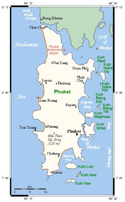
Phuket Island Map
Phuket is Thailand's largest island and nestles against the Indian Ocean Coast some 870 kilometers south of Bangkok. Phuket derives its wealth from tin and rubber, is blessed with teeming marine life, and has enjoyed a rich and colorful history.

Phuket is also one of the major Asian gateways for ocean cruises. Recently a new concept has emerged: Spa Cruises. Combining Thai traditional ways of relaxing the body and mind with all amenities of an up-market cruise

Phuket Island
Phuket is blessed with magnificent coves and bays, powdery, palm- fringed white beaches, sparkling island-dotted seas, sincerely hospitable people, comfortable accommodation, superb seafood, lushly forested mountains, lovely waterfalls and parks, and delightful turn-of -the-century Indo / Portuguese and Chinese-influenced architecture which create an enchanting ambiance perfectly suited to total relaxation.

Indeed, Phuket is a major resort of international stature, possessing everything necessary for a truly memorable holiday. First-class hotels located within town offer complimentary transport to their own beach clubs. Economy-class hotels are also available within town. First-class resort hotels with spectacular views offer air-conditioned accommodation, as do many cabin and bungalow complexes on Phuket's most popular beaches. Yet other 'native-style' complexes, built of bamboo, rattan and Nipa palm thatch, Phuket's coastal hills and beaches to offer comfortable and relatively inexpensive accommodation.

Phuket Island
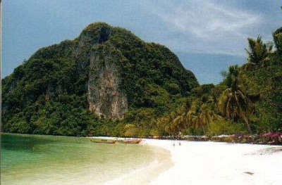
Phuket's glory is its magnificent coastline. Beaches range from gentle crescents of white sand with calm waters to rocky headlands pounded by raging surf. Secluded coves lie hidden among densely forested headlands tumbling around white beaches. In several such places, visitors can feel years away from civilization. Phuket's Indian Ocean coastline boasts the finest beaches while the eastern coastline overlooks some 30 lesser islands occupying largely tranquil seas. Islands vary greatly size, some are large enough to sustain fishing communities, coconut plantations, deer and wild boar. Others are little larger than massive rocks. Others again resemble fortresses, are riddled with caves containing the birds' nests prized by gourmets.

Phuket - Phi Phi Island
Phuket's nightlife is sedate and is concentrated largely in the town center and Patong Beach in restaurants, bars (many featuring video entertainment), massage parlors, nightclubs and discotheques.

Angkor Wat - Stunning Khmer Capital

The UNESCO-recognised World Heritage Site of Angkor Wat and its surrounding temples are arguably the most important and impressive temple complex in Asia. Built by the powerful Khmer civilization between 802 and 1220 AD the temples represent one of mankind's most astonishing and enduring architectural achievements and it is no surprise when one gazes upon it to learn it was from here that the Khmer kings ruled over a vast empire that stretched from Vietnam to China and across to the Bay of Bengal. This is truly Cambodia’s greatest site.

Angkor Wat
The period today referred to as the “Angkor Period” stretched from 812AD to 1432AD. During this time the Khmer kings built a city from which they ruled a vast empire, with a capital first at Phnom Kulen, 40km northeast of Angkor, and then around and at the site of what we refer to as Angkor Wat today.

Much of what we see and admire dates from what is known as the Classical Age; Angkor Wat the largest and best preserved temple at the site it was built for King Suryavarman ll in the early 12th century as his state temple and capital city. Everything here is built on a huge scale leaving one to imagine what the area was like when populated by up to a million people, the largest city of its time, their wooden houses eaten away by time and the jungle.

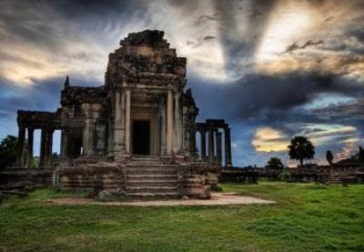
Angkor Wat Library
Angkor was to remain ‘lost’, ‘undiscovered’ by Western archaeologists at least, until the late 19th century when the French archaeologist Henri Mouhot came across it in 1868 ands whose prosaic description of the walled city clad in jungle created the image we still have today.

There are countless temples at Angkor but some of the main one of course, is Angkor Wat itself, regarded as the masterpiece of Khmer architecture; the walled city of Angkor Thom; the Baphuon, an 11th century temple with a 131-foot reclining Buddha; the Bayon, famous for its superb bas-reliefs and mysterious faces and Ta Prohm, still cloaked in jungle.

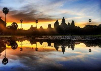
Angkor Wat Sunset
A minimum of two days and preferably 4 are needed to get to grips with the full extent of Angkor Wat. A guide is essential at some point given the 7-century history of the area and to begin to appreciate the achievements of the Khmer civilisation. Entry tickets are available in 1, 3 and 7 day durations (passport photo required for multi-day passes).

Sunrise or sunset at the site is a must, but also good is to head to Ta Phrom where the tree roots of the jungle add to the atmosphere of being in that legendary ‘lost city’.

Angkor Wat West Gate
There are a number of ways to explore, but on foot and by bike are the best. Cyclos too are fun – and easier on the legs in the hot sun. For those that want a bit of a different perspective on the region there are elephant and hot-air balloon rides. Those with deep pockets can even hire a helicopter.

Tuesday, January 27, 2009

The Boracay Island


Geographically speaking, Boracay is part of the municipality of Malay in the province of Aklan, which is located in Panay, one of a cluster of islands that constitute the central section of the Philippine archipelago.

Boracay can be reached from Manila by daily flights on Philippine Airlines, Cebu Pacific, Air Philippines, Asian Spirit, Seair and Pacific Air. Caticlan is nearer the island, but the airstrip is short and narrow, and only the smaller planes of Asian Spirit, Seair and Pacific Air can land on it. The larger aircraft of Philippine Airlines, Cebu Pacific and Air Philippines fly to Kalibo, the capital of Aklan. From Caticlan it takes about 15 minutes by boat to Boracay; from Kalibo, an hour and a half by bus plus the 15-minute boat ride.


Once on the island, you will find out that getting around is simple and easy. There are three categories of transport: pedicabs and motorized tricycles shared with other passengers; individually rented bicycles and motorbikes; and the shuttle service offered by some hotels. Taxis are not available. However, since everything is more or less within walking distance, you will most likely join the majority of visitors in moving around the island on foot.

Boracay is seven kilometers long and divided into three barangays, or communities. Yapak lies in the north, Balabag in the center and Manoc-Manoc in the south. Within these barangays are smaller villages such as Angol, Manggayad and Bolabog.

Yapak is spread out over hilly terrain situated some distance away from the main tourist beat, but the shoreline is dotted with beautiful, uncrowded beaches and coves such as Puka Beach and Balinghai Beach . The island's only golf club, the 18-hole par-72 course at Fairways & Bluewater , is also located in Yapak. The Bat Caves , a popular destination for nature lovers, can be found at the barangay's northeastern tip.

White Beach , Boracay's biggest tourist attraction, stretches some four kilometers on the western side of the island, mostly within the barangay of Balabag. It is largely because of the pristine, white powdery sand of White Beach and the crystal-clear blue water of the surrounding sea that Boracay is often called "the world's most beautiful tropical island."


While White Beach takes up most of the western shoreline, Bolabog Beach dominates the eastern coast. Bolabog (sometimes spelled "Bulabog" or "Bulabug") belongs to the barangay of Balabag (with very little difference in spelling, Bolabog is often confused with Balabag by newcomers to the island). Normally the boat trip from Caticlan terminates at White Beach, but during the monsoon season when the western side of the island is lashed by strong winds, visitors are brought to a docking area in Bolabog. The waters here are also considered to offer ideal conditions for windsurfing. A small dirt road takes you from Bolabog to the foot of Mount Luho , the highest point on the island.

Understandably hotels on White Beach attract the most guests. The northern end of the beach is "lorded over" by Fridays , the southern end by Lorenzo South . In between you will find all kinds of accommodation, from native bamboo-and-nipa bungalows to Western-style concrete buildings.

White Beach extends into Manoc-Manoc, but the barangay features its own share of beaches worth visiting and exploring, including one named Manoc-Manoc Beach . The barangay also encompasses the Boracay Beach & Yacht Club and Crocodile Island, a popular destination for picnics, diving expeditions and marine excursions. The Dead Forest , a scenic spot believed to be populated by elemental spirits, is likewise located within the boundaries of Manoc-Manoc. White Beach Path runs along White Beach but is set back from the shore by rows of coconut trees. Hotels, eateries, bars, stores and dive shops line the entire length of the meandering footpath. This is where visitors to the island come to see and be seen.

You will find hotels like the longstanding Red Coconut Resort and more recently constructed Boracay Regency Beach Resort on White Beach Path, and likewise the Tourist Center , a handy one-stop shop for all kinds of travel needs (airline reservations, postcards, stamps, film, souvenirs and so forth). Thai Castles, True Food, Steakhouse Boracay , Gorio's , La Reserve Restaurant , Banza and La Capannina are among the better known eateries. Bars include Bom Bom and Summer Place Bar & Restaurant . Victory Divers and Aquarius Diving are just two of the many dive shops (there are more than 20 such outlets on the island) scattered along the path. Retail stores range from Paulo Collection Body Wear to Lonely Planet. The Talipapa Market, which burnt down in early 2005, has now been rebuilt in several locations between White Beach Path and Boracay Main Road .


Tricycles ply Boracay Main Road and a handful of side streets but are not allowed on White Beach Path. Except for Jony's Beach Resort , the town square (where the church and DOT Office are located), Beachcomber Bar & Disco , Moondog Shooter Bar , Pink Patio Resort and a few other establishments, there are not many places geared toward tourists on the main road. You may, however, ride a tricycle on the road to get to a hotel or an eatery on White Beach Path; just get off at the nearest stop and walk the rest of the way.

To facilitate locating an establishment on the island, the nearest boat station is often specified in its address. Here a word on these stations is in order: Numbered 1, 2 and 3, they are used as stopping-off points by boats ferrying new arrivals from Caticlan. Do not, however, expect some well-constructed structure with a welcoming jetty for you to conveniently step on. To disembark, you can go for one of two options: Jump into the water and wade ashore or allow yourself the luxury of being borne aloft on the shoulders of some hapless porter. Happy landing!

Sunday, January 25, 2009

The Grand Canyon

The Grand Canyon is a steep-sided gorge carved by the Colorado River in the United States state of Arizona. It is largely contained within the Grand Canyon National Park — one of the first national parks in the United States. President Theodore Roosevelt was a major proponent of preservation of the Grand Canyon area, and visited on numerous occasions to hunt and enjoy the scenery.

Longstanding scientific consensus has been that the canyon was created by the Colorado River over a six million year period. The canyon is 277 miles (446 km) long, ranges in width from 4 to 18 miles (6.4 to 29 km) and attains a depth of over a mile (1.83 km)(6000 feet). Nearly two billion years of the Earth's history have been exposed as the Colorado River and its tributaries cut their channels through layer after layer of rock while the Colorado Plateau was uplifted. The "canyon began in the west, followed by another that formed in the east. Eventually, the two broke through and met as a single majestic rent in the earth some six million years ago. The merger apparently occurred where the river today bends to the west, in the area known as the Kaibab Arch."
Before European emigration, the area was inhabited by Native Americans who built settlements within the canyon and its many caves. The Pueblo people considered the Grand Canyon ("Ongtupqa" in Hopi language) a holy site and made pilgrimages to it. The first European known to have viewed the Grand Canyon was García López de Cárdenas from Spain, who arrived in 1540. In 1869, Major John Wesley Powell, a one-armed Civil War veteran, made the first recorded journey through the canyon on the Colorado River. Powell referred to the sedimentary rock units exposed in the canyon as "leaves in a great story book."

The Great Pyramid of Giza

The Great Pyramid of Giza, also called Khufu's Pyramid or the Pyramid of Khufu, and Pyramid of Cheops, is the oldest and largest of the three pyramids in the Giza Necropolis bordering what is now Cairo, Egypt, and is the only remaining member of the Seven Wonders of the Ancient World. It is believed the pyramid was built as a tomb for Fourth dynasty Egyptian King Khufu (Cheops in Greek) and constructed over a 20 year period concluding around 2560 BC. The Great Pyramid was the tallest man-made structure in the world for over 3,800 years. Originally the Great Pyramid was covered by casing stones that formed a smooth outer surface, and what is seen today is the underlying core structure. Some of the casing stones that once covered the structure can still be seen around the base. There have been varying scientific and alternative theories regarding the Great Pyramid's construction techniques. Most accepted construction theories are based on the idea that it was built by moving huge stones from a quarry and dragging and lifting them into place.
There are three known chambers inside the Great Pyramid. The lowest chamber is cut into the bedrock upon which the pyramid was built and was unfinished. The so-called Queen's Chamber and King's Chamber are higher up within the pyramid structure. The Great Pyramid of Giza is the main part of a complex setting of buildings that included two mortuary temples in honor of Khufu (one close to the pyramid and one near the Nile), three smaller pyramids for Khufu's wives, an even smaller "satellite" pyramid, a raised causeway connecting the two temples, and small mastaba tombs surrounding the pyramid for nobles.

The Stonehenge

Stonehenge is a prehistoric monument located in the English county of Wiltshire, about 3.2 kilometres (2.0 mi) west of Amesbury and 13 kilometres (8.1 mi) north of Salisbury. One of the most famous prehistoric sites in the world, Stonehenge is composed of earthworks surrounding a circular setting of large standing stones and sits at the centre of the densest complex of Neolithic and Bronze Age monuments in England, including several hundred burial mounds. Archaeologists had believed that the iconic stone monument was erected around 2500 BC, as described in the chronology below. However one recent theory has suggested that the first stones were not erected until 2400-2200 BC, whilst another suggests that bluestones may have been erected at the site as early as 3000 BC (see phase 1 below). The surrounding circular earth bank and ditch, which constitute the earliest phase of the monument, have been dated to about 3100 BC. The site and its surroundings were added to the UNESCO's list of World Heritage Sites in 1986 in a co-listing with Avebury henge monument, and it is also a legally protected Scheduled Ancient Monument. Stonehenge itself is owned by the Crown and managed by English Heritage while the surrounding land is owned by the National Trust.
New archaeological evidence found by the Stonehenge Riverside Project indicates that Stonehenge served as a burial ground from its earliest beginnings. The dating of cremated remains found that burials took place as early as 3000 B.C, when the first ditches were being built around the monument. Burials continued at Stonehenge for at least another 500 years when the giant stones which mark the landmark were put up. According to Professor Mike Parker Pearson, head of Stonehenge Riverside Project:
"Stonehenge was a place of burial from its beginning to its zenith in the mid third millennium B.C. The cremation burial dating to Stonehenge's sarsen stones phase is likely just one of many from this later period of the monument's use and demonstrates that it was still very much a domain of the dead."

History of The Statue of Liberty

History of The Statue of Liberty

The Statue of Liberty National Monument officially celebrated her 100th birthday on October 28, 1986. The people of France gave the Statue to the people of the United States over one hundred years ago in recognition of the friendship established during the American Revolution. Over the years, the Statue of Liberty's symbolism has grown to include freedom and democracy as well as this international friendship.

Sculptor Frederic Auguste Bartholdi was commissioned to design a sculpture with the year 1876 in mind for completion, to commemorate the centennial of the American Declaration of Independence. The Statue was a joint effort between America and France and it was agreed upon that the American people were to build the pedestal, and the French people were responsible for the Statue and its assembly here in the United States. However, lack of funds was a problem on both sides of the Atlantic Ocean. In France, public fees, various forms of entertainment, and a lottery were among the methods used to raise funds. In the United States, benefit theatrical events, art exhibitions, auctions and prize fights assisted in providing needed funds.
Meanwhile in France, Bartholdi required the assistance of an engineer to address structural issues associated with designing such a colossal copper sculpture. Alexandre Gustave Eiffel (designer of the Eiffel Tower) was commissioned to design the massive iron pylon and secondary skeletal framework which allows the Statue's copper skin to move independently yet stand upright. Back in America, fund raising for the pedestal was going particularly slowly, so Joseph Pulitzer (noted for the Pulitzer Prize) opened up the editorial pages of his newspaper, "The World" to support the fund raising effort. Pulitzer used his newspaper to criticize both the rich who had failed to finance the pedestal construction and the middle class who were content to rely upon the wealthy to provide the funds. Pulitzer's campaign of harsh criticism was successful in motivating the people of America to donate.
Financing for the pedestal was completed in August 1885, and pedestal construction was finished in April of 1886. The Statue was completed in France in July, 1884 and arrived in New York Harbor in June of 1885 on board the French frigate "Isere" which transported the Statue of Liberty from France to the United States. In transit, the Statue was reduced to 350 individual pieces and packed in 214 crates. The Statue was re-assembled on her new pedestal in four months time. On October 28th 1886, the dedication of the Statue of Liberty took place in front of thousands of spectators. She was a centennial gift ten years late.
The story of the Statue of Liberty and her island has been one of change. The Statue was placed upon a granite pedestal inside the courtyard of the star-shaped walls of Fort Wood (which had been completed for the War of 1812.) The United States Lighthouse Board had responsibility for the operation of the Statue of Liberty until 1901. After 1901, the care and operation of the Statue was placed under the War Department. A Presidential Proclamation declared Fort Wood (and the Statue of Liberty within it) a National Monument on October 15th, 1924 and the monument's boundary was set at the outer edge of Fort Wood. In 1933, the care and administration of the National Monument was transferred to the National Park Service. On September 7, 1937, jurisdiction was enlarged to encompass all of Bedloe's Island and in 1956, the island's name was changed to Liberty Island. On May 11, 1965, Ellis Island was also transferred to the National Park Service and became part of the Statue of Liberty National Monument. In May of 1982, President Ronald Reagan appointed Lee Iacocca to head up a private sector effort to restore the Statue of Liberty. Fundraising began for the $87 million restoration under a public/private partnership between the National Park Service and The Statue of Liberty-Ellis Island Foundation, Inc., to date the most successful public-private partnership in American history. In 1984, at the start of the Statue's restoration, the United Nations designated the Statue of Liberty as a World Heritage Site. On July 5, 1986 the newly restored Statue re-opened to the public during Liberty Weekend, which celebrated her centennial.
Text courtesy of the National Park Service

The Statue of Liberty

The Statue of Liberty (French: Statue de la Liberté), or, more formally, Liberty Enlightening the World (French: La liberté éclairant le monde), was presented to the United States by the people of France in 1886. Standing on Liberty Island in New York Harbor, it welcomes visitors, immigrants, and returning Americans traveling by ship. The copper-clad statue, dedicated on October 28, 1886, commemorates the centennial of the signing of the United States Declaration of Independence and was given to the United States to represent the friendship established during the American Revolution. Frédéric Auguste Bartholdi sculpted the statue and obtained a U.S. patent for its structure. Maurice Koechlin - chief engineer of Gustave Eiffel's engineering company and designer of the Eiffel Tower - engineered the internal structure. Eugène Viollet-le-Duc was responsible for the choice of copper in the statue's construction and adoption of the repoussé technique, where a malleable metal is hammered on the reverse side.

The statue is of a robed woman holding a torch, and is made of a sheeting of pure copper, hung on a framework of steel (originally puddled iron) with the exception of the flame of the torch, which is coated in gold leaf (originally made of copper and later altered to hold glass panes). It stands atop a rectangular stonework pedestal with a foundation in the shape of an irregular eleven-pointed star. The statue is 151 ft (46 m) tall, but with the pedestal and foundation, it is 305 ft (93 m) tall.
Worldwide, the Statue of Liberty is one of the most recognizable icons of the United States and was, from 1886 until the jet age, often one of the first glimpses of the United States for millions of immigrants after ocean voyages from Europe. Visually, the Statue of Liberty appears to draw inspiration from il Sancarlone or the Colossus of Rhodes.

The statue is the central part of Statue of Liberty National Monument, administered by the National Park Service.

The general appearance of the statue’s head approximates the Roman Sun-god Apollo or the Greek Sun-god Helios as preserved on an ancient marble tablet (today in the Archaeological Museum of Corinth, Corinth, Greece) - Apollo was represented as a solar deity, dressed in a similar robe and having on its head a "radiate crown" with the seven spiked rays of the Helios-Apollo's sun rays, like the Statue's nimbus or halo. The ancient Colossus of Rhodes, one of the Seven Wonders of the Ancient World, was a statue of Helios with a radiate crown. The Colossus is referred to in the 1883 sonnet The New Colossus by Emma Lazarus. Lazarus's poem was later engraved on a bronze plaque and mounted inside the Statue of Liberty in 1903.
The statue, also known affectionately as "Lady Liberty", has become a symbol of freedom and democracy. She welcomed arriving immigrants, who could see the statue as they arrived in the United States. There is a version of the statue in France given by the United States in return.

The classical appearance (Roman stola, sandals, facial expression) derives from Libertas, ancient Rome's goddess of freedom from slavery, oppression, and tyranny. Her raised right foot is on the move. This symbol of Liberty and Freedom is not standing still or at attention in the harbor, it is moving forward, as her left foot tramples broken shackles at her feet, in symbolism of the United States' wish to be free from oppression and tyranny. The seven spikes on the crown epitomize the Seven Seas and seven continents. Her torch signifies enlightenment. The tablet in her hand represents knowledge and shows the date of the United States Declaration of Independence, in roman numerals, July IV, MDCCLXXVI.

Monday, January 19, 2009

The Leaning Tower of Pisa

The Leaning Tower of Pisa (Italian: Torre pendente di Pisa) or simply The Tower of Pisa (La Torre di Pisa) is the campanile, or freestanding bell tower, of the cathedral of the Italian city of Pisa. It is situated behind the cathedral and is the third oldest structure in Pisa's Piazza del Duomo (Cathedral Square) after the cathedral and the baptistry.
Although intended to stand vertically, the tower began leaning to the southeast soon after the onset of construction in 1173 due to a poorly laid foundation and loose substrate that has allowed the foundation to shift direction. The tower presently leans to the southwest.
The height of the tower is 55.86 m (183.27 ft) from the ground on the lowest side and 56.70 m (186.02 ft) on the highest side. The width of the walls at the base is 4.09 m (13.42 ft) and at the top 2.48 m (8.14 ft). Its weight is estimated at 14,500 metric tons (16,000 short tons). The tower has 296 or 294 steps; the seventh floor has two fewer steps on the north-facing staircase. The tower leans at an angle of 3.97 degrees. This means that the top of the tower is 3.9 metres (12 ft 10 in) from where it would stand if the tower were perfectly vertical.

Construction
The Tower of Pisa was a work of art, performed in three stages over a period of about 177 years. Construction of the first floor of the white marble campanile began on August 9, 1173, a period of military success and prosperity. This first floor is surrounded by pillars with classical capitals, leaning against blind arches.
The tower began to sink after construction progressed to the third floor in 1178. This was due to a mere three-meter foundation, set in weak, unstable subsoil. This means the design was flawed from the beginning. Construction was subsequently halted for almost a century, because the Pisans were almost continually engaged in battles with Genoa, Lucca and Florence. This allowed time for the underlying soil to settle. Otherwise, the tower would almost certainly have toppled. In 1198, clocks were temporarily installed on the third floor of the unfinished construction.
In 1272, construction resumed under Giovanni di Simone, architect of the Camposanto. In an effort to compensate for the tilt, the engineers built higher floors with one side taller than the other. This made the tower begin to lean in the other direction. Because of this, the tower is actually curved. Construction was halted again in 1284, when the Pisans were defeated by the Genoans in the Battle of Meloria.
The seventh floor was completed in 1319. The bell-chamber was not finally added until 1372. It was built by Tommaso di Andrea Pisano, who succeeded in harmonizing the Gothic elements of the bell-chamber with the Romanesque style of the tower. There are seven bells, one for each note of the musical scale. The largest one was installed in 1655.
After a phase (1990-2001) of structural strengthening, the tower is currently undergoing gradual surface restoration, in order to repair visual damage, mostly corrosion and blackening. These are particularly strong due to the tower's age and to its particular conditions with respect to wind and rain.
The architect
There has been controversy about the real identity of the architect of the Leaning Tower of Pisa. For many years, the design was attributed to Guglielmo and Bonanno Pisano, a well-known 12th-century resident artist of Pisa, famous for his bronze casting, particularly in the Pisa Duomo. Bonanno Pisano left Pisa in 1185 for Monreale, Sicily, only to come back and die in his home town. His sarcophagus was discovered at the foot of the tower in 1820. However recent studies seem to indicate Diotisalvi as the original architect due to the time of construction and affinity with other Diotisalvi works, notably the bell tower of San Nicola (Pisa) and the Baptistery in Pisa. However, he usually signed his works and there is no signature by him in the bell tower which leads to further speculation.